Another Chesapeake Bay Bridge
 My last post, which was about an event that happened on the Eastern Shore of Maryland back in 1933, included a map like the one above, minus all the red lines. Those red lines are the potential locations for the proposed new bridge which is needed to ease traffic congestion. When one is built it is likely to be beside the other two which are located on the map in the middle between Annapolis and Queenstown.
Prior to the early 1950s, the peninsula was more isolated than it looks and, before the arrival of TV, the residents on it were more insular than they now are. I was born there and those of us who were, did not sound like those on the Mainland when we talked and we were perceived to be, and generally were, more southern in orientation. Harriet Tubman was also born there.
The geographical and social isolation caused by the Bay, meant that those on the Shore had to either drive many miles to catch a ferry, or drive many more miles all the way up to the top of the Bay and then go back south to get to Baltimore or Washington. It was somewhat like driving from London, Ontario to Cleveland, Ohio.

As a ferry leaves its slip, a motorcade crosses the new Chesapeake Bay Bridge after dedication, July 30, 1952. In the lead cars are then-Maryland Gov. Theodore Roosevelt McKeldin, Delaware Gov. Elbert Carvel, former Maryland Gov. William Preston Lane Jr. and their wives. Prior to the completion of the bridge, a ferry brought passengers and about 50 vehicles across the water, from Annapolis to Matapeake. The trip took about 45 minutes, although lines to get on board often backed up hours, especially in summer. (Photo: AP)
The trip was made easier in 1952 when the Chesapeake Bay Bridge was built. We could head off to the cities without worrying about ferry schedules and the urban folks could visit Ocean City. Problems remained, however, since the much larger number of cars had to travel on two-lane roads and bridges and through the streets of small towns. Heading out of Baltimore on a Friday for the beach at Ocean City quickly became problematic, and equally so on the return trip Sunday night. It was somewhat like travelling from Toronto to Muskoka.
 By the early 1970s it was clear that another bridge was needed and it was built next to the other one. Highways were also improved on the Shore and bypasses were built around the towns. Ocean City grew, along with the size of the waterfront lots along the many rivers. The charms of the Shore lured many to the counties closest to the bridges which are now clogged with those trying to get to work in Baltimore and D.C.
Now, because of repair work on one of the bridges there are again major traffic jams. A third span is required and there will soon be construction along one of those red lines. Many Marylanders are in favour, particularly the daily commuters and hotel and restaurant owners in Ocean City. Some in the small towns, like Saint Michaels and Easton, which have been gentrified and already have too much traffic, are not. I am not sure how the Lower Shore watermen and farmers feel, but they will probably not benefit from what is gained and feel most what is lost.
Sources:
There is a web site for the Chesapeake Bay Bridge (with some live cameras) and a Wikipedia entry.
For an article about the proposed new bridge see: "A New Bridge Close to the Chesapeake Bay Bridge Would Provide the Most Traffic Relief, Study Says," Katherine Shaver, Washington Post, Aug. 27, 2019.
Post Script:
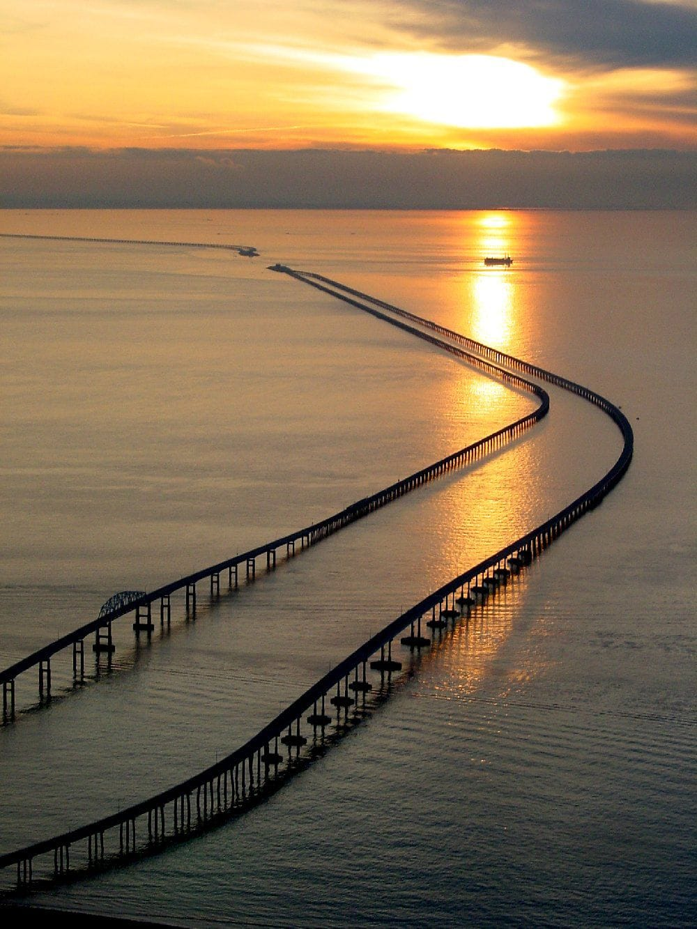 At the southern tail-end of the peninsula one also had to take a ferry to get to the Mainland until 1964 when a bridge-tunnel was built. The bridge goes out into open water to some artificial islands and then goes under the channel. The distance across is about 28km as opposed to the 7km of the Chesapeake Bay Bridge.
No comments:
Post a Comment